Searching for the Dutch-Paris Escape Line
That’s Not the Map of Dutch-Paris
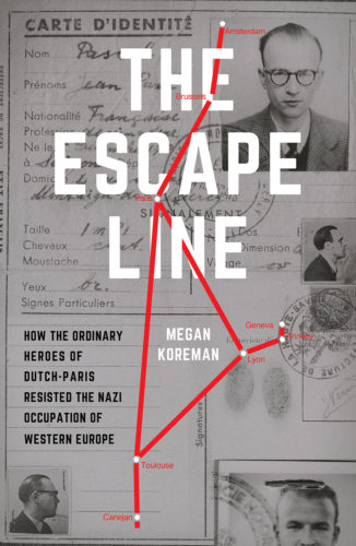
I’ve finally figured out why the map on the first version of the cover for The Escape Line was wrong. I couldn’t understand why the designer had included towns that were not part of Dutch-Paris’s routes. But I had made the mistake of assuming that the designer had based the cover on the photos and maps in the book or even read the book.
Then I saw the small promotional piece that a local librarian posted for a talk I gave in January. There was that same incorrect map. And this time I recognized it because the map was part of a commemorative stamp cover released in the 1980s. I’d seen it before in the Weidner archives and read quite a bit of correspondence about it. The commemorative stamps were part of a gambit of men who had not been part of Dutch-Paris to claim that they were actually the leaders of Dutch-Paris. A scandal ensued in the world of Dutch resisters, leading to the disgrace of the pretenders.
Where on earth, I wondered, had a librarian in Michigan found this image? She told me she found it on google images and used it because it had a horizontal axis that fit into their web page better than the vertical photos I had sent her. Fair enough, and it does say Dutch-Paris on the image. Presumably the cover designer found that map the same way.
But this is the problem with relying on the internet for research. The image shows up because the commemorative cover is being offered for sale. That image says Dutch-Paris on it and the map is partially correct. But there’s no context with it. There’s no explanation of what Dutch-Paris was or who these people who signed the cover were. There’s certainly no commentary about the scandal the cover unleashed.
I’m not saying that the internet is not a useful tool. But it should be handled with care, and with skepticism.


Leave a reply